Beacon Quest: Jubilee Weekend 2012
Something a little different ....
Background: I don't get away much these days, mostly it's just on MBA business, but for once I was determined to have a holiday going where I wanted, when I wanted, doing what I wanted. I decided on Wales because it's was easy for me to get too, I'd not been there for a few years, and there were things to do if the weather was bad. Then I discovered a beacon was due to be lit on Snowdon to celebrate the Jubilee and the idea arose that it'd be rather fun to sit on a different hill and photograph the event from afar. Moel Meirch, north of the Moelwyns looked a good spot with plenty of spots suitable for camping in the area, plus it would allow me to bag a few 2,000 footers that were still outstanding from pervious trips (mostky in my long distant youth). The week beforehand had been a heatwave. But the weather still looked good for the Jubilee. Until a couple of days before. And then it all changed .....
Thursday 31st May
It was raining in Machynleth. So much for plan A to start the trip with a traverse of the Tarrens. So I continued on the train and by Barmouth it was just drizzly. But the cloud level was almost down to the beach. Plan B then: bus to Llanelltyd and walk in to Penrhos bothy for the first night. It had the added attraction of being an easy walk .... Although the disadvantage that I wasn't entirely sure on how to pronounce Llanelltyd. So far as I could make out, the correct pronounciation sounded nothing at all like how the name was written. Would the driver know where I meant? I coped out and used the 'English' pronounciation - which the driver immediately corrected me by saying something which sounded almost but not entirely like a word that looked nothing like Llanelltyd. I checked my ticket - at least it was spelt right ....
Off at the bridge (which Google Earth marked as being a bus stop but the driver proclaimed was definitely not one!) and then a misty, muggy walk up the quiet, narrow, lane that runs down the east side of the lower Afon Mawddach. With a heavy sack it still took me an hour and a half to get to Penrhos, but I wasn't exactly rushing. The mist swam swam through the tips of the trees, like something out of a Stephen King book. Occassionally a beast howled in the depths of the forest (I later decided it was a two stroke engine, possibly a motorbike. Do beasts ride bikes these days?). Penrhos was in fine shape.
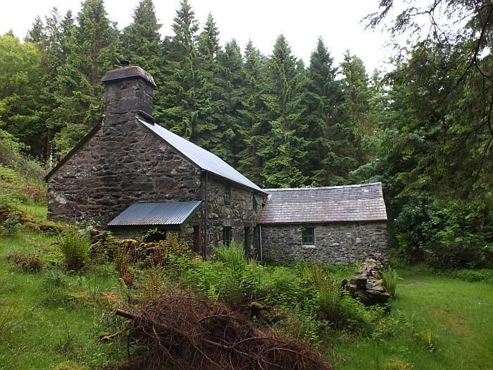
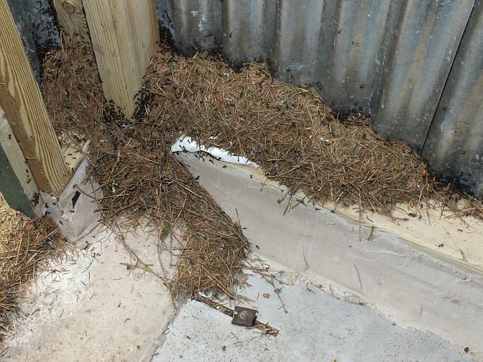
Although I noted that the wood ants were busy building a new nest around the door to the privy: go to the loo and you really will get ants in your pants!
A quiet night alone. Nice.
Friday 1st June
Next morning I woke early, but the mist still hung around the tree tops. Well, I had, quite literally, all day to get to wherever it was I decided to go today. Which was, er, hmmm ...... I don't know. I didn't need to get to Blaenau until Monday. I procrastinated. I'm good at that. In fact, these days it's about the only thing I really am good at. If only it were an Olympic event, Britain would be assured of gold every time .....
Eventually, with the mist having risen and the sun breaking through the cloud, I set off. It was about 11am. Late for sure, but as I said, I had all day - or at least, until at least 8pm to give time to find and set up camp for the night. There was a bus from Ganllwyd up to Blaenau Ffestinog and with the weather hopefully set fine for the next couple of days (based on yesterdays forecast - with no mobile reception I was unable to check the latest charts) I thought I'd get up there early, have a look around the old quarries and bag a few 2000 footers before the big event.
I've walked down the 'alpine route' from Penrhos to Ganllwyd before. And caught a bus from Ganllwyd before. So I knew the way. Down through the trees was easy. But once on the lower track by the Mawddach the question arose: how do I get to the bridge? To which the answers is: I still don't know. Despite having done it before, I just could not find any path from the track to the river side. I could see the bl**dy bridge. But I could not get to it. Hmmm, well in that case ..... I just carried on along the track. Plan B. Or is it C? Or in fact, was it A? An easy day following paths along the Mawddach and then up through the top part of the Coed y Brenin, passed a wee building I wanted to check out, and then camp somewhere below Arenig Fawr. An easy day's walk.
Now, by this time it was getting quite hot. And I was getting quite sweaty. My feet were a little damp. But it was easy going ....
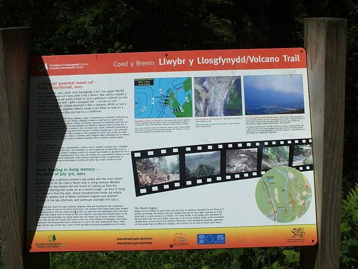
A plaque by the next bridge (too late now cross over and back track to Ganllwyd) described the events of the great flood of 3rd July 2004 - I'd seen it before. My friend John Mason produced it and just downstream of here is an impressive 'tree wrap' which I'd visited with John and frends Sam and Adi back in September 2005.
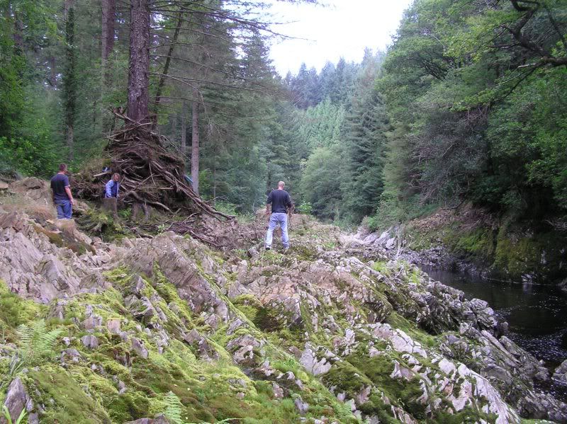
Note how high it is above the 'normal' water level and the amount of debris that has become wrapped around the upright tree. John is in the centre closest to the wrap and really gives it scale.
A couple of miles and an hour or so later I reached the impressive falls of the Rhaedr Mawddach - site also of an old gold mine.
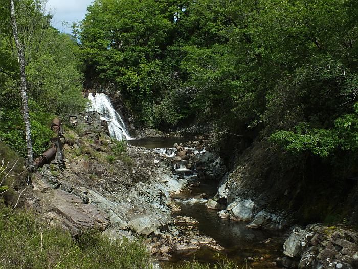
A half hour's rest and then, after crossing the bridge above the falls and turning left I moved away from the waymarked trails of the Coed y Brenin. A little further on a ford provided a quiet lunch stop in the sun, and a chance to cool my feet in the Mawddach waters. Lovely! My socks were quite wet, mostly from sweat, but all my spare, dry, socks were somewhere right at the bottom of my sack and I couldn't be bothered emptying it to get at them. So I put damp socks back on when I set off once more.
The forest track became a bridelway and led up across farmland to the derelict farmhouse at Tyddyn Mawr - which appears to be undergoing some restoration work. Or, at least, the barn alongside does. It'd make a grand home with a fine view down the Mawddach valley and across to the southern Rhiniogs.
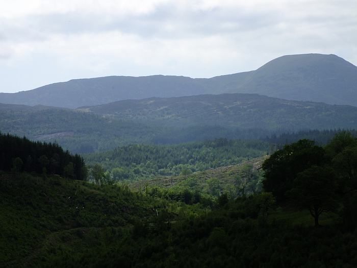
Beyond the farmhouse, the bridleway ran once more through forestry, or in this case the sad ruined scorched earthed remains of what once was forestry before they came along and chopped all the trees down. Like Yppes but without the mud. And with a lot more tree stumps. And no machine gun fire. Or screams. Or barbed wire. It was quiet and sunny. So, I suppose, not actually like Yppes at all really.
The track was stoney and ran up and down and up and down until it re-entered mature forestry. The forest track is not the actual right of way but the actual right of way doesn't appear to exist .... but eventually I found my way down to Pont Aber where, by the tiny chapel, I stopped for another rest. My feet were a bit sore by now. And as I pulled off my still wet socks I discovered I had a small blister forming .... Now how on Earth could that have happened? I stuck a plaster on ..... and then my still damp socks. You know where this is heading .....
I crossed over the Mawddach and took the farm track to Brin Llin-fawr and thence the good foresty track up through the northern reach of Coed y Brenin. They have several dogs at Brin Llin-fawr. And by the sounds of it, a pack of wolves. Who were most annoyed that I didn't come and say hello to them. And so let the rest of Wales know it. The Hound of the Baskerville would have been cowering in fear at the cacophany that howled up the valley. Three police forces were alerted. And the US set a task force to investigate ..... Embarrassed, I quickly pushed on.
It was now quite overcast, but still and muggy And midgy. So little chance for a stop. Until I reached what had been intended as a tea break stop and now looked certain to be my night's destination. I'd made a meal of an easy half day's walk. About 8 miles. I was knackered. Mind, the fact the last backpacking trip I'd done was in April last year; an overnighter in the Brecon Beacons and even the last hill I had climbed had been in the Cheviots back in August last year and I'd spent most of the intervening time sat on my arse eating and drinking too much and resolutely doing no exercise at all, may just have had a small something to do with the state I was rapidly finding myself in. Odd really though; 25 years ago I'd have walked all this before breakfast ....
Anyway, I reached the place I called The Byre. I knew it had in the past been used as a bothy. And fortunately just before setting off on this trip I'd heard that the roof had been blown off over the winter ....
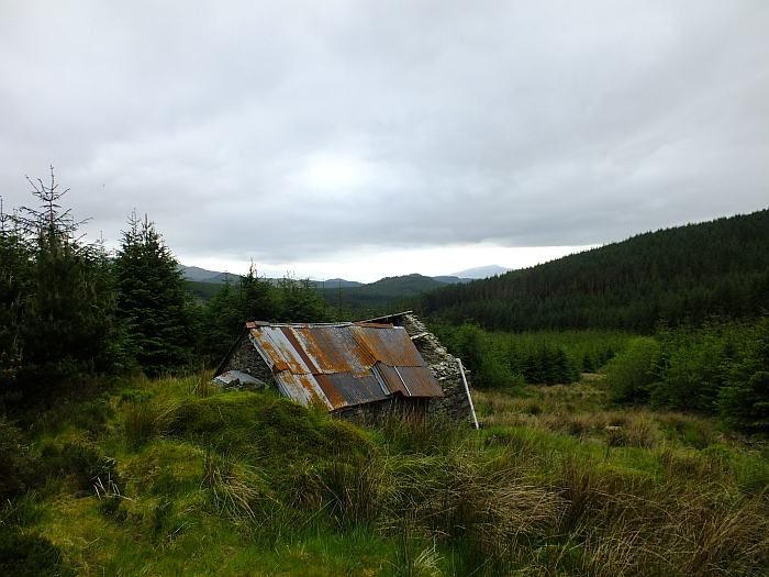
The hole in the roof let the midges in but also more light. It was pretty dire inside though and I decided to pitch my tent, but at least use the ruined bothy to cook in.
A mild night but a cloudy one and once again there was low mist come morning.
Saturday 2nd June
I made an earlier start, pushing on up through the rest of the forestry in dense mizzle. Once again, I had no idea where I was heading. But the forecast had been for rain on Sunday so I wanted a slightly more comodious bothy tonight, especially as I might well end up having to spend two nights there. But the only bothy I could get to - unless I went back to Penrhos - was the small hut beneath Arenig Fawr. And if anyone else were there it'd be rather crowded. Added to which, it took me a bit out of my way if I wanted to be above Ffestiniog to see the Snowdon Beacon on Monday night.
I reached the public road at the top of the foresty, still in the mist, and for the first time since leaving Barmouth managed to get a signal on my mobile phone. Unfortunately the forecast has not changed: tomorrow was going to be very wet.
So I decided to take a gamble. After all, they always pay off. High above Llan Ffestiniog, beside the Llynnau Gamallt, is a building marked on the map as a 'shooting hut'. I understood it to be an unlocked shelter. A bothy. But I had no idea how popular it might be or what condition it would be inside. However, the location looked splendid and assuming I had a rest day tomorrow (which, let's face it, my body was now demanding on pain of all out stoppage) I'd be ideally placed for a perfect walk on Monday around the quarries above Ffestiniog and then, after dropping down into the village and stocking up on food, up towards Moel Meirth for a high level camp from which to watch the beacon. Perfect? Of course. It's not even a gamble ....
To get there I needed the bus from Bronaber to Llan Ffestiniog and to get the bus from Bronaber it was an easy, mostly downhill walk along what proved to be one of the remotest roads in Wales. It's the only one I know which actually has a gate across it (right at he highest point, just by the end of the forestry). Just north was a 2000 footer I had though would make an easy diversion, but the mist had swallowed it up so I pushed straight on down towards Pont y Gain. Around me, signs warned that this area had once been used for army firing practice and I must not leave the road or touch anything I found. Which seemed bizarre given that the whole area had since been covered in forestry, most of which had then been felled ..... Anyway, it's possible this military presence explains why, a little further on from Pony y Gain I discovered a secret military bunker!
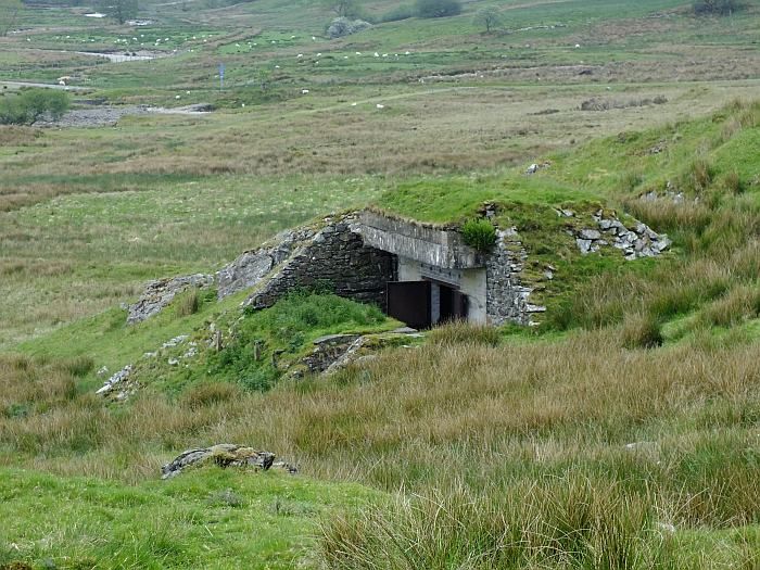
It looks to me like a gun emplacement of some kind. But it's now used only by sheep .... A training ground for ovine terrorists?!
Up and over a low ridge, through the Trawsfynydd Holiday Village and a 40 minute wait in the sun for the bus to Llan Ffestiniog - which I managed to pronounce in perfect Welsh!
In Ffestiniog I made a quick visit to the small village shop to add an extra evening's meal to my sack and also a couple of cans of cider. It was still calm and warm, though sunshine was becoming rather patchy. Another sweaty haul up the road into Cwm Teigl. Which probably isn't pronounced tickle. Nice views over to the Moelwyns though.
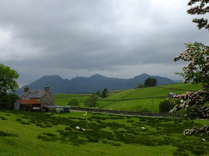
The map showed a footpath over to the Shooting Hut. And roughly where I though it should go from, a grassy track led up the hillside. For about 20 yards. Oh well, I zig-zagged on up the steep incline beneath grey crags and eventually reached the top of the ridge from which I hoped to see Llynnau Gamallt. Except it wasn't there. I was too far south. I'd climbed up too early. Obvious as soon as I looked at the map. But not to worry, another path along the ridge soon got me to where I should be from whence it was an easy half a mile ....... across tussocky spagnum bog with absolutely no path whatsoever. At least I didn't need to worry about wet feet now I was so near to 'home'.
The cloud was slowly dropping and the wind picking up. I reached the hut at 6pm and within an hour the mist was down and it was raining. Good timing. Maybe not such a good destination though. At least, unlike the Byre, the roof was (nearly) intact - though a few slates were missing and there was one hole in the roof. The floor was rough and stoney. There were several chairs and a table and a fireplace that had seen better days (and I don;t mean it had been to a Springsteen concert) and had no chance of seeing a fire anyway because there was no fuel of any sort in the vicinity. I have actually stayed in worse places. But not often.
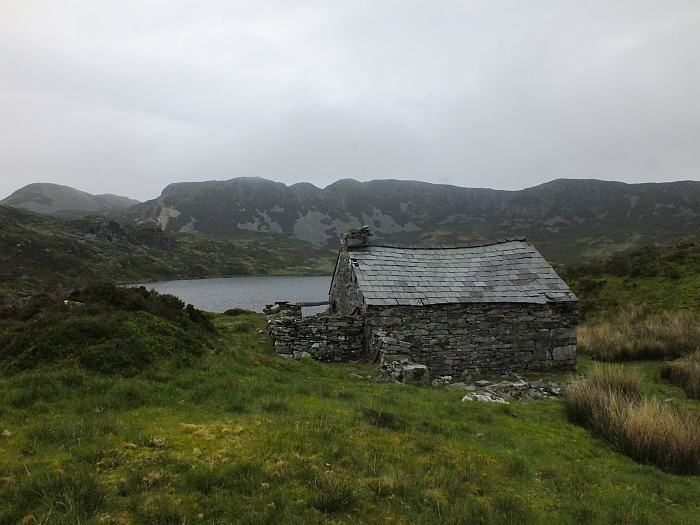
Like it or not, this was going to be my home for the next 2 nights .....
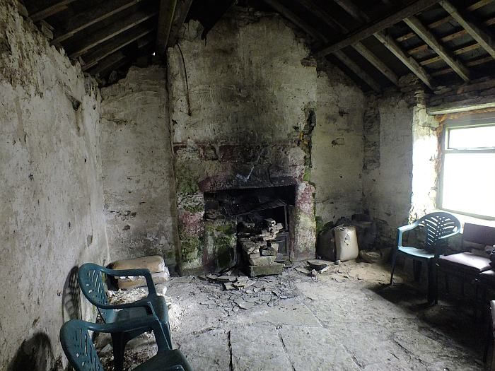
At least I had plenty of food. And it was drier than being in a little tent.
Sunday 3rd June
There is not much to say about this sad and miserable day. The wind howled, the rain poured, the mist hung about the eaves of the hut, and I spent almost the whole day sat in my sleeping bag eating, drinking and reading. I probably ate more than I had done in the previous two days. Although I'd brought provisions for such an eventuality. It was cold too. I later discovered it hadn't been much better at home in Evesham.
Monday 4th June - Beacon Day!
But eventually the storm moved away. The rain stopped. Overnight the wind eased. And come Monday morning there were signs that the cloud would rise and break and we might even see the Sun. Even the hut looked cheerier.
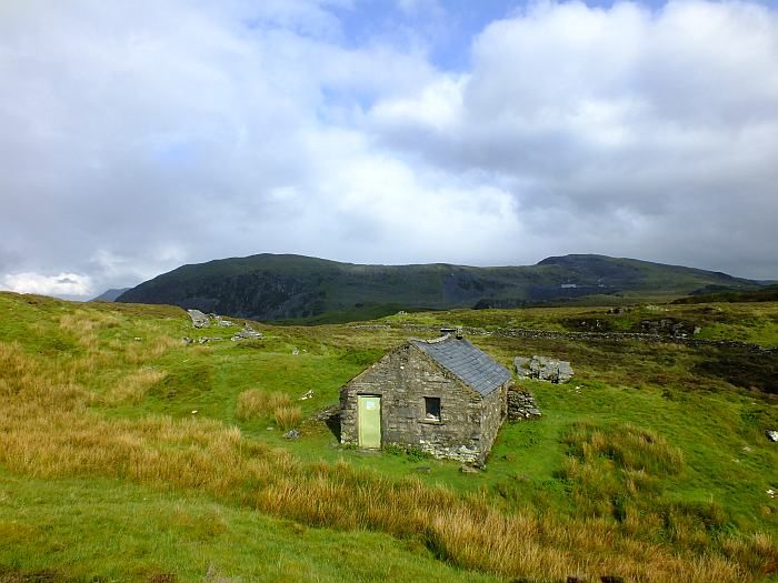
All I had to do now was get into position to watch the beacon. An easy walk around the Manod and Maen Offeren quarries, down to Blaenau and then up the other side to camp high ....
And the rest had done my feet good. I set off in dry socks. Which were soaked five minutes later and increasingly saturated over the next mile of spagnum bog through which another footpath marked on the map totally and utterly failed to exist in any form whatsoever. Except perhaps on a quantum leve in an alternative universe. And the imagination of the mapmaker. At one stage it was so wet there were rotting posts protruding from the bog that had once been a fence to keep even the sheep out.
But I made it through to the road, just below the Manod Quarries. This time I changed my sodden socks straight away for dry ones. Athough as my boots were also sodden, my dry socks were sodden as well a minute later ..... I hung the first pair on my rucksack in the hope they'd dry a bit, and set off along the old trainway, around the back of Manod Fach (I had first intended climbing Manod Mawr, but there didn't seem to be an easy path and the tramway looked easier and - look this is my holiday and I can do what I want, I don't have to climb silly hills you know!).
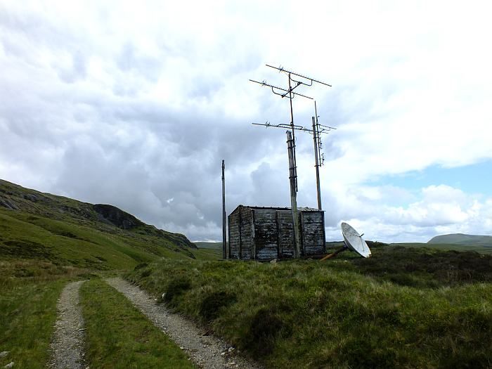
A derelict radio hut looked quite bizarre - it even has a rusting satellite dish outside and along with various bits of wrecked electonics, a TV set inside.
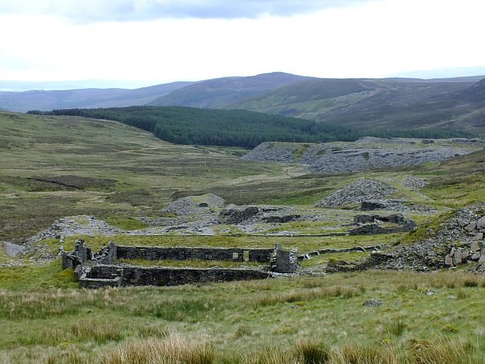
A little further on where more 'traditional' quarry ruins
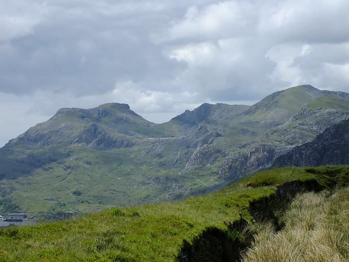
And round the next bend, there appeared Snowdon for the first time
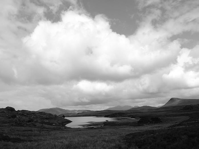
It occurred to me than that this would actually be quite a good spot to watch the beacon from - except I needed now to drop down into Blaenau to stock up on supplies .... Damn. But still plenty of time to push on to Moel Meirch - which was one of those lumps on the plateau between here and Snowdon.
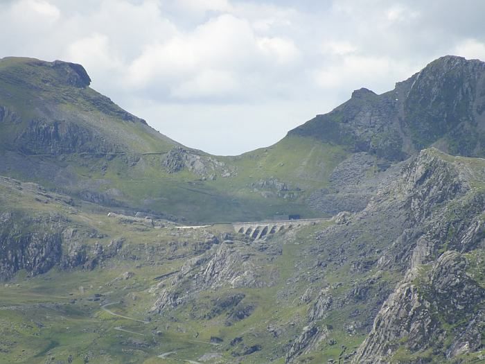
The clouds broke more and the sun came out more and although it wasn't exactly hot, it was pleasant enough to have a decent wash in a leat that tracked round the edge of the quarry, and sit in peace looking out over the ruins of the upper quarry and the distant Moelwyns. Absolutely no-one else about. Apart from some sheep.
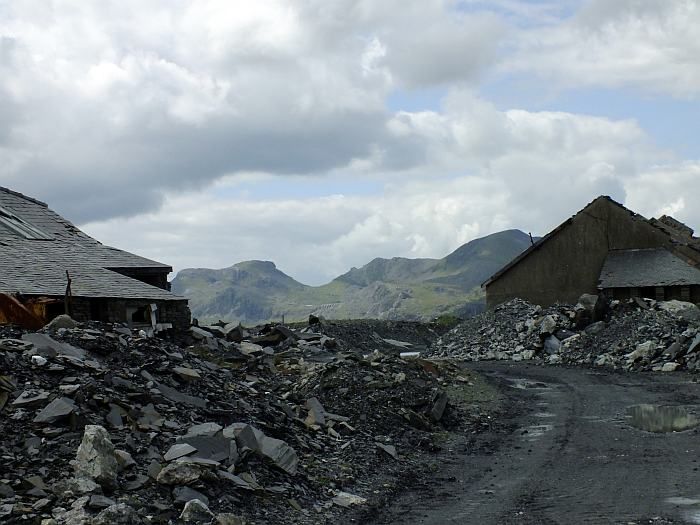
After an hour, I dropped down a steep incline to the upper quarry to have a look around.
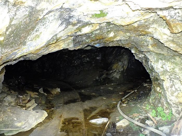
I found one of the main mines, but didn't venture any further inside - a signed warned of detonations planned for 2010 ...
I kept expecting the seven dwarves to turn up at any minute ....
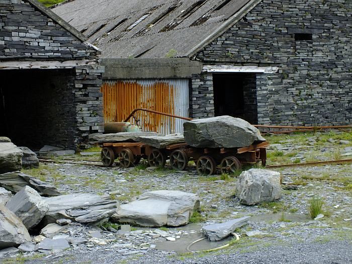
The next 'level' down is still being worked as a quarry but being a bank holiday there was no-one around. A public right of way does actually go through the quarry, though my route wasn't entirely on it.
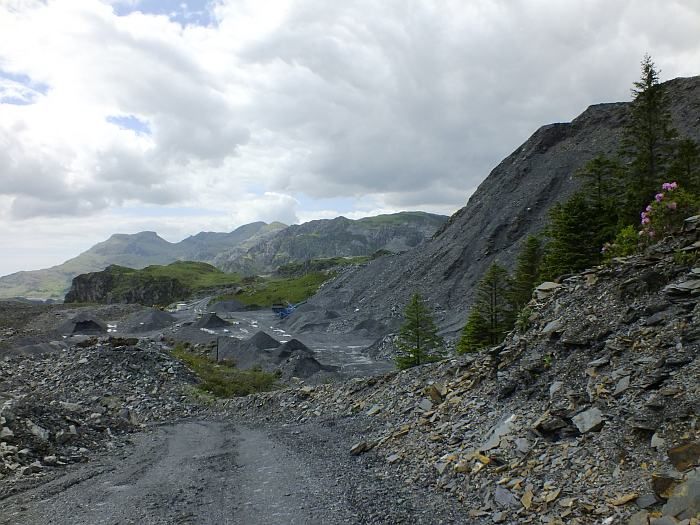
It was quite a long, steep descent and at every step I was conscious of the height lost - and height that would have to be regained. Down in Blaenau I bought some supplies at the Co-op and then sat down to think on what to do next. It was warm, it was pleasant, I hadn't actually walked all that far ..... but my feet were already tired again. The main problem was that I had to get out to the coast for the train home. And there were no buses until Wednesday. Tuesday however was currently being forecast to turn wet once more .... The only alternative was the steam train. And the more I thought, the more I liked this idea (it's a HOLIDAY - I don't have to climb hills and I can go on a steam train if I want!) The first train out in Tuesday wasn't until 11.50am though, and assuming a wet morning, I really didn't want to be stuck in the village till then. However, there was a train due in in a few minutes. And it was rather a nice afternoon. Better a train ride in the sun than the rain, surely? So why not?
And so the train arrived
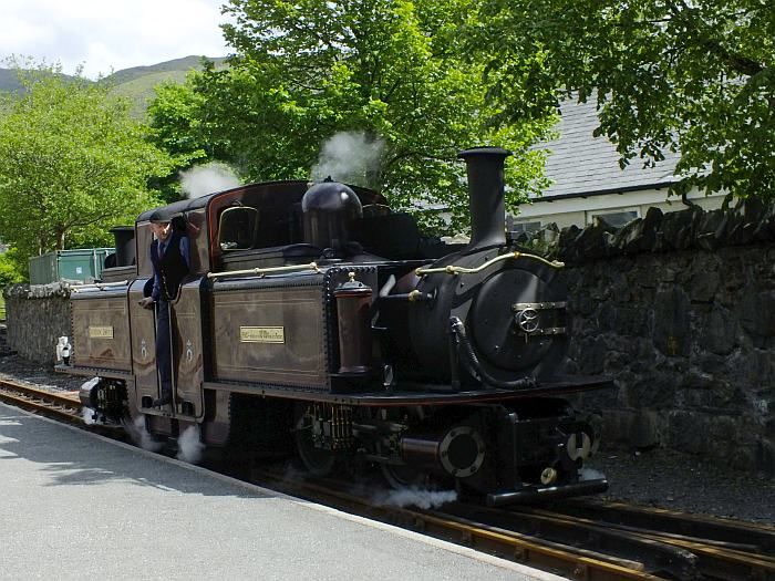
And I found myself jiggled and jaggled and joggled (it's not the smoothest of rides, especially sitting in the rear coach) all the way down to Porthmadog.
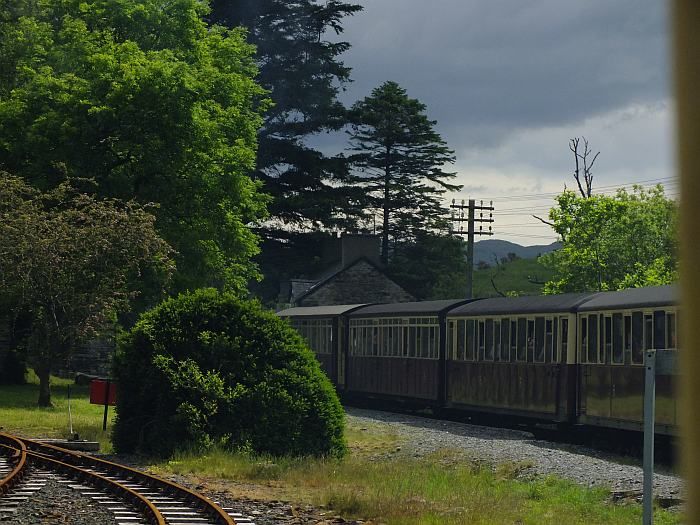
Of course, the problem now was that I could no longer sit up near Moel Meirch and watch the beacon being lit. Which had definitely been plan A all along. Hmmm. And then as we crossed the cob, I saw it again: Snowdon!
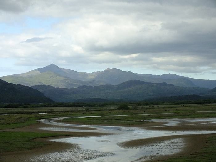
I hadn't realised how prominent the hill was to the north of Porthmadog. Nor, that directly south of here was Morfa Harlech - a huge expanse of sand dunes which would make quite a pleasant place to sit and watch the beacon from. And which didn't invove any ascent at all. Perfect. Plan B. It's a rap! (btw I like both Porthmadog and Harlech because they're easy to pronouce in a good Welsh accent without get your tongue tied in knots!)
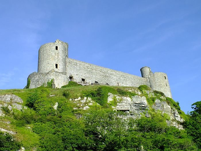
I took the Arriva train down to Harlech and the castle watched me walk out to the beach.
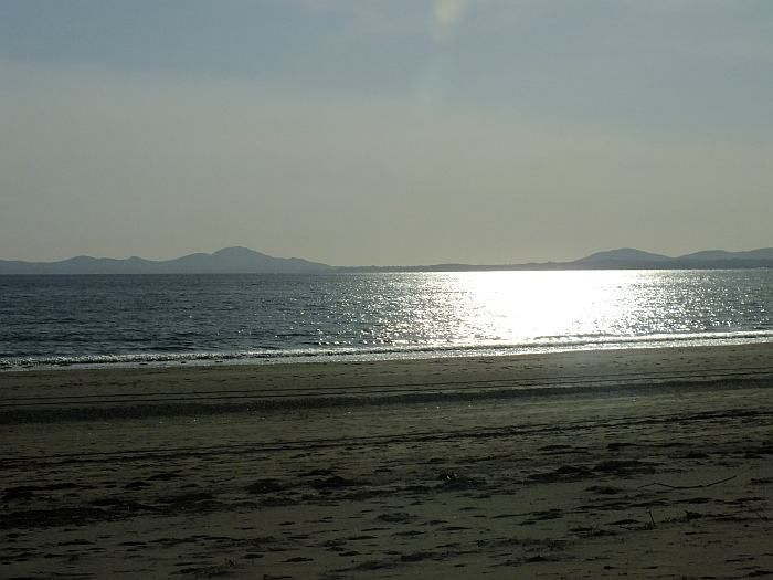
And what a beach it was! With the silvery sea and distant hills of Lleyn:
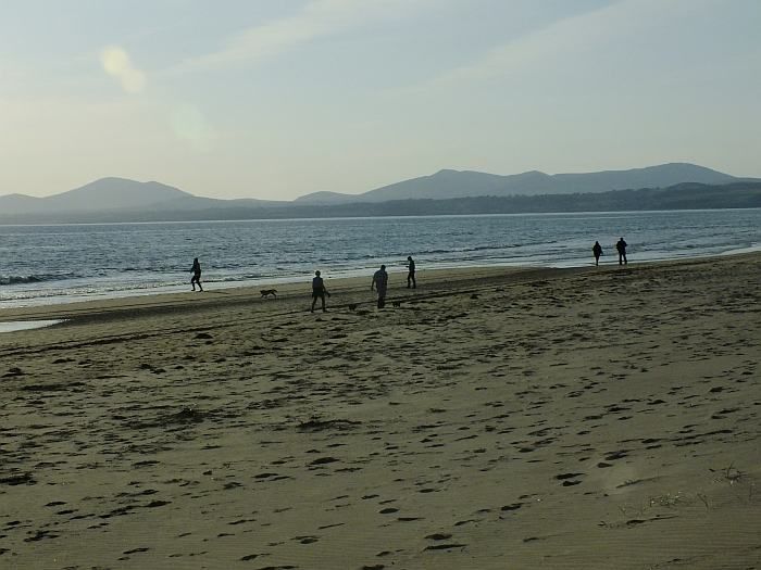
There were still a few folk about on the beach and I walked about a half a mile along it to find a nice quiet spot. I set my camera up on a tripod, sips a can or two of cider, and watched the tide come in
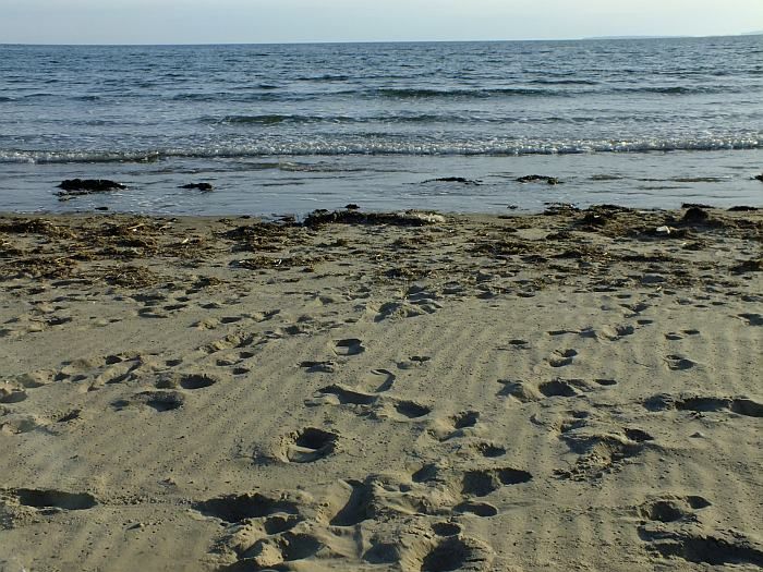
And in
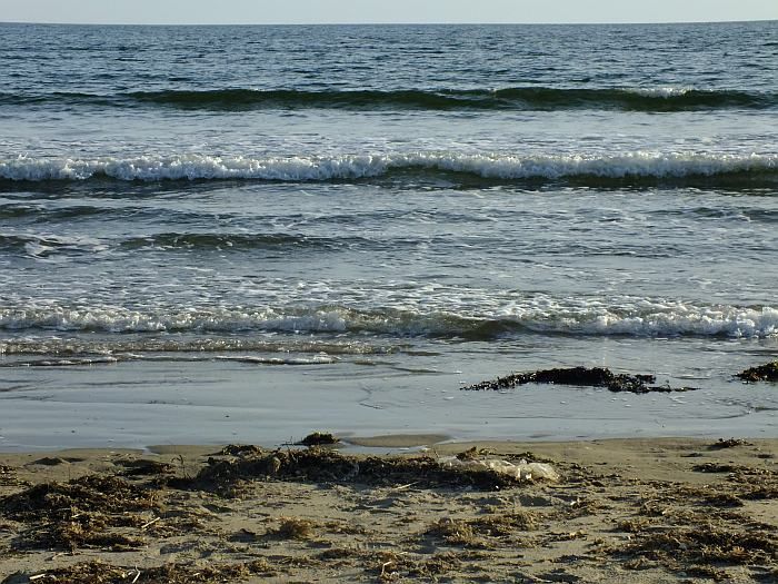
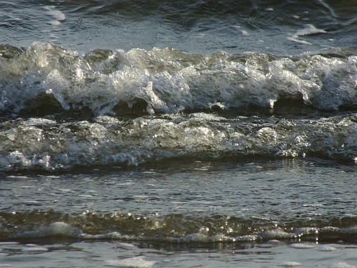
And in
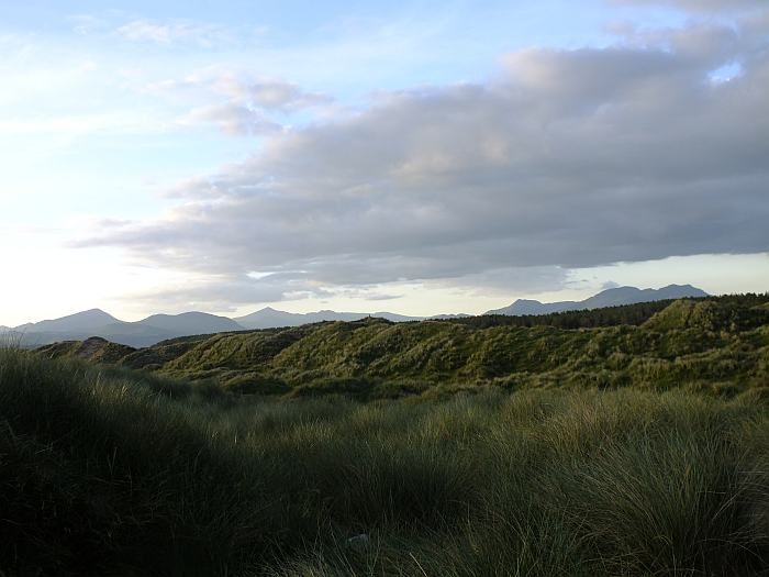
And then up onto the dunes to check I could see Snowdon. Yep, there it is, left of centre (Moel Hebog on the left with Cnicht and the Moelwyns to the right)
But let's just zoom in to be sure ...
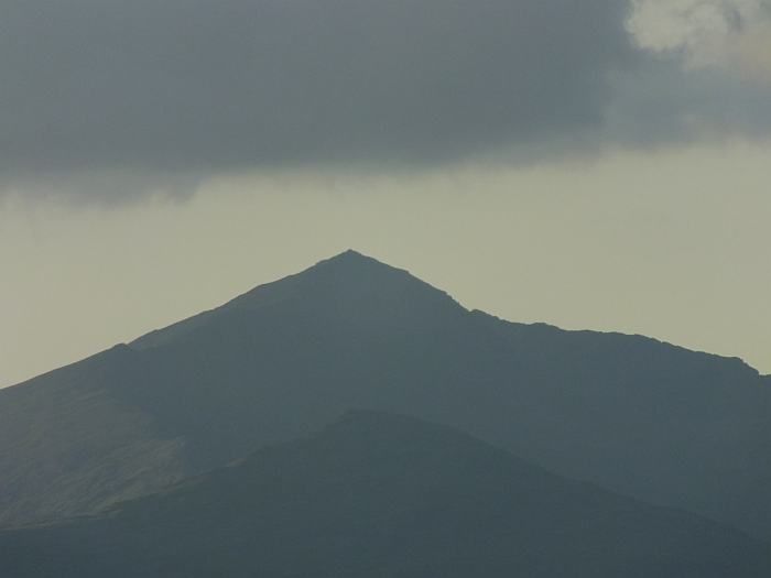
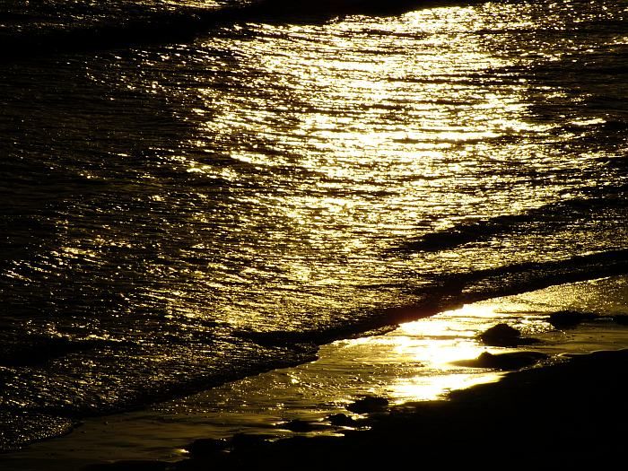
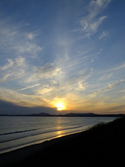
Yep, that's Snowdon all right! So now we just sit and wait. And watch the sun going down and the sea turn to molten gold:
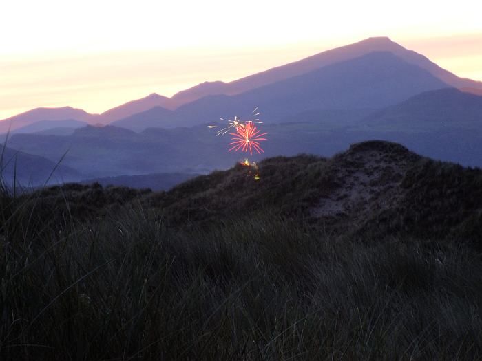
Suddenly, my peace was broken by a commotion - lights! It was a firework display in Portmadog. Or at least, I think it was. Closer examination of the photos suggest the fireworks may have been much smaller and closer than I thought ...... after all, even the sand fairies of Morfa Harlech would surely want to celebrate Her Majesty's Jubilee?
10pm, the time the beacons were due to be lit, came and passed. Nothing to be seen. Maybe the Snowdon beacon had been cancelled? I sat alone on the beach, with just the sound of the waves for company. And then, two UFOs appeared to the right of Crib Coch ......
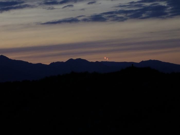
Ogwen Valley MRT had set off flares as their beacon (not visible from here) was lit. But what of Snowdon?
And then ......
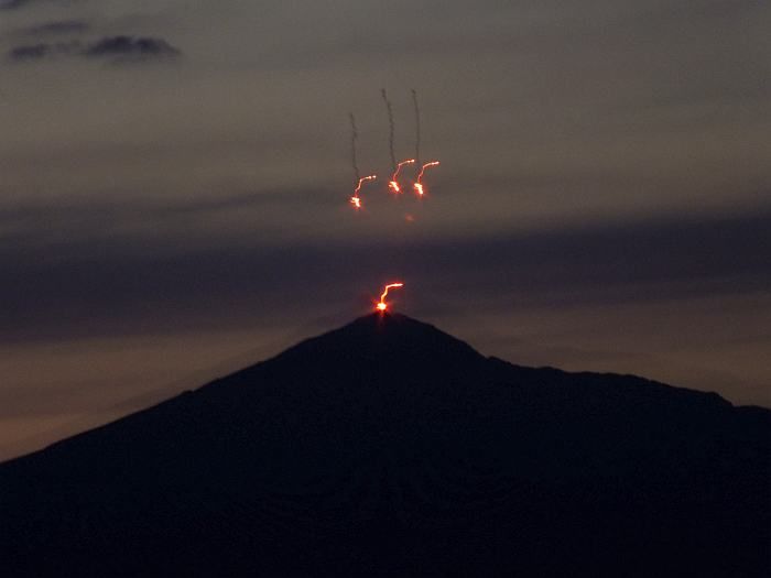
Yes! Although the beacon itself proved hard to see, just visible occasionally as it briefly fared up (I suspect it was situated just the other side of the summit cairn so mostly out of sight from the coast) flares were also set off and I managed the photo I had came for. Success.
And then, the flares ended and I was left alone once more, to finish my cider and watch the Moon rise over Harlech, as a few Chinese lanterns drifted by ....
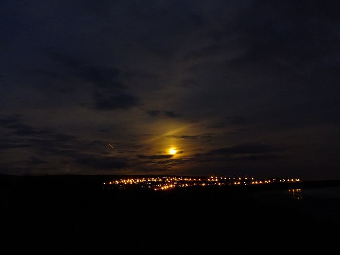
Next morning I woke to a smir of rain. Radar showed there wouldn't be much rain here till later, but I saw little point in hanging around. I packed my tent and caught the early train home.
A couple of days later, aches and pains all gone, I felt fitter than I have done in years. Right, I'm ready now for a holiday
Background: I don't get away much these days, mostly it's just on MBA business, but for once I was determined to have a holiday going where I wanted, when I wanted, doing what I wanted. I decided on Wales because it's was easy for me to get too, I'd not been there for a few years, and there were things to do if the weather was bad. Then I discovered a beacon was due to be lit on Snowdon to celebrate the Jubilee and the idea arose that it'd be rather fun to sit on a different hill and photograph the event from afar. Moel Meirch, north of the Moelwyns looked a good spot with plenty of spots suitable for camping in the area, plus it would allow me to bag a few 2,000 footers that were still outstanding from pervious trips (mostky in my long distant youth). The week beforehand had been a heatwave. But the weather still looked good for the Jubilee. Until a couple of days before. And then it all changed .....
Thursday 31st May
It was raining in Machynleth. So much for plan A to start the trip with a traverse of the Tarrens. So I continued on the train and by Barmouth it was just drizzly. But the cloud level was almost down to the beach. Plan B then: bus to Llanelltyd and walk in to Penrhos bothy for the first night. It had the added attraction of being an easy walk .... Although the disadvantage that I wasn't entirely sure on how to pronounce Llanelltyd. So far as I could make out, the correct pronounciation sounded nothing at all like how the name was written. Would the driver know where I meant? I coped out and used the 'English' pronounciation - which the driver immediately corrected me by saying something which sounded almost but not entirely like a word that looked nothing like Llanelltyd. I checked my ticket - at least it was spelt right ....
Off at the bridge (which Google Earth marked as being a bus stop but the driver proclaimed was definitely not one!) and then a misty, muggy walk up the quiet, narrow, lane that runs down the east side of the lower Afon Mawddach. With a heavy sack it still took me an hour and a half to get to Penrhos, but I wasn't exactly rushing. The mist swam swam through the tips of the trees, like something out of a Stephen King book. Occassionally a beast howled in the depths of the forest (I later decided it was a two stroke engine, possibly a motorbike. Do beasts ride bikes these days?). Penrhos was in fine shape.

Although I noted that the wood ants were busy building a new nest around the door to the privy: go to the loo and you really will get ants in your pants!

A quiet night alone. Nice.
Friday 1st June
Next morning I woke early, but the mist still hung around the tree tops. Well, I had, quite literally, all day to get to wherever it was I decided to go today. Which was, er, hmmm ...... I don't know. I didn't need to get to Blaenau until Monday. I procrastinated. I'm good at that. In fact, these days it's about the only thing I really am good at. If only it were an Olympic event, Britain would be assured of gold every time .....
Eventually, with the mist having risen and the sun breaking through the cloud, I set off. It was about 11am. Late for sure, but as I said, I had all day - or at least, until at least 8pm to give time to find and set up camp for the night. There was a bus from Ganllwyd up to Blaenau Ffestinog and with the weather hopefully set fine for the next couple of days (based on yesterdays forecast - with no mobile reception I was unable to check the latest charts) I thought I'd get up there early, have a look around the old quarries and bag a few 2000 footers before the big event.
I've walked down the 'alpine route' from Penrhos to Ganllwyd before. And caught a bus from Ganllwyd before. So I knew the way. Down through the trees was easy. But once on the lower track by the Mawddach the question arose: how do I get to the bridge? To which the answers is: I still don't know. Despite having done it before, I just could not find any path from the track to the river side. I could see the bl**dy bridge. But I could not get to it. Hmmm, well in that case ..... I just carried on along the track. Plan B. Or is it C? Or in fact, was it A? An easy day following paths along the Mawddach and then up through the top part of the Coed y Brenin, passed a wee building I wanted to check out, and then camp somewhere below Arenig Fawr. An easy day's walk.
Now, by this time it was getting quite hot. And I was getting quite sweaty. My feet were a little damp. But it was easy going ....
A plaque by the next bridge (too late now cross over and back track to Ganllwyd) described the events of the great flood of 3rd July 2004 - I'd seen it before. My friend John Mason produced it and just downstream of here is an impressive 'tree wrap' which I'd visited with John and frends Sam and Adi back in September 2005.


Note how high it is above the 'normal' water level and the amount of debris that has become wrapped around the upright tree. John is in the centre closest to the wrap and really gives it scale.
A couple of miles and an hour or so later I reached the impressive falls of the Rhaedr Mawddach - site also of an old gold mine.

A half hour's rest and then, after crossing the bridge above the falls and turning left I moved away from the waymarked trails of the Coed y Brenin. A little further on a ford provided a quiet lunch stop in the sun, and a chance to cool my feet in the Mawddach waters. Lovely! My socks were quite wet, mostly from sweat, but all my spare, dry, socks were somewhere right at the bottom of my sack and I couldn't be bothered emptying it to get at them. So I put damp socks back on when I set off once more.
The forest track became a bridelway and led up across farmland to the derelict farmhouse at Tyddyn Mawr - which appears to be undergoing some restoration work. Or, at least, the barn alongside does. It'd make a grand home with a fine view down the Mawddach valley and across to the southern Rhiniogs.

Beyond the farmhouse, the bridleway ran once more through forestry, or in this case the sad ruined scorched earthed remains of what once was forestry before they came along and chopped all the trees down. Like Yppes but without the mud. And with a lot more tree stumps. And no machine gun fire. Or screams. Or barbed wire. It was quiet and sunny. So, I suppose, not actually like Yppes at all really.
The track was stoney and ran up and down and up and down until it re-entered mature forestry. The forest track is not the actual right of way but the actual right of way doesn't appear to exist .... but eventually I found my way down to Pont Aber where, by the tiny chapel, I stopped for another rest. My feet were a bit sore by now. And as I pulled off my still wet socks I discovered I had a small blister forming .... Now how on Earth could that have happened? I stuck a plaster on ..... and then my still damp socks. You know where this is heading .....
I crossed over the Mawddach and took the farm track to Brin Llin-fawr and thence the good foresty track up through the northern reach of Coed y Brenin. They have several dogs at Brin Llin-fawr. And by the sounds of it, a pack of wolves. Who were most annoyed that I didn't come and say hello to them. And so let the rest of Wales know it. The Hound of the Baskerville would have been cowering in fear at the cacophany that howled up the valley. Three police forces were alerted. And the US set a task force to investigate ..... Embarrassed, I quickly pushed on.
It was now quite overcast, but still and muggy And midgy. So little chance for a stop. Until I reached what had been intended as a tea break stop and now looked certain to be my night's destination. I'd made a meal of an easy half day's walk. About 8 miles. I was knackered. Mind, the fact the last backpacking trip I'd done was in April last year; an overnighter in the Brecon Beacons and even the last hill I had climbed had been in the Cheviots back in August last year and I'd spent most of the intervening time sat on my arse eating and drinking too much and resolutely doing no exercise at all, may just have had a small something to do with the state I was rapidly finding myself in. Odd really though; 25 years ago I'd have walked all this before breakfast ....
Anyway, I reached the place I called The Byre. I knew it had in the past been used as a bothy. And fortunately just before setting off on this trip I'd heard that the roof had been blown off over the winter ....

The hole in the roof let the midges in but also more light. It was pretty dire inside though and I decided to pitch my tent, but at least use the ruined bothy to cook in.
A mild night but a cloudy one and once again there was low mist come morning.
Saturday 2nd June
I made an earlier start, pushing on up through the rest of the forestry in dense mizzle. Once again, I had no idea where I was heading. But the forecast had been for rain on Sunday so I wanted a slightly more comodious bothy tonight, especially as I might well end up having to spend two nights there. But the only bothy I could get to - unless I went back to Penrhos - was the small hut beneath Arenig Fawr. And if anyone else were there it'd be rather crowded. Added to which, it took me a bit out of my way if I wanted to be above Ffestiniog to see the Snowdon Beacon on Monday night.
I reached the public road at the top of the foresty, still in the mist, and for the first time since leaving Barmouth managed to get a signal on my mobile phone. Unfortunately the forecast has not changed: tomorrow was going to be very wet.
So I decided to take a gamble. After all, they always pay off. High above Llan Ffestiniog, beside the Llynnau Gamallt, is a building marked on the map as a 'shooting hut'. I understood it to be an unlocked shelter. A bothy. But I had no idea how popular it might be or what condition it would be inside. However, the location looked splendid and assuming I had a rest day tomorrow (which, let's face it, my body was now demanding on pain of all out stoppage) I'd be ideally placed for a perfect walk on Monday around the quarries above Ffestiniog and then, after dropping down into the village and stocking up on food, up towards Moel Meirth for a high level camp from which to watch the beacon. Perfect? Of course. It's not even a gamble ....
To get there I needed the bus from Bronaber to Llan Ffestiniog and to get the bus from Bronaber it was an easy, mostly downhill walk along what proved to be one of the remotest roads in Wales. It's the only one I know which actually has a gate across it (right at he highest point, just by the end of the forestry). Just north was a 2000 footer I had though would make an easy diversion, but the mist had swallowed it up so I pushed straight on down towards Pont y Gain. Around me, signs warned that this area had once been used for army firing practice and I must not leave the road or touch anything I found. Which seemed bizarre given that the whole area had since been covered in forestry, most of which had then been felled ..... Anyway, it's possible this military presence explains why, a little further on from Pony y Gain I discovered a secret military bunker!

It looks to me like a gun emplacement of some kind. But it's now used only by sheep .... A training ground for ovine terrorists?!
Up and over a low ridge, through the Trawsfynydd Holiday Village and a 40 minute wait in the sun for the bus to Llan Ffestiniog - which I managed to pronounce in perfect Welsh!
In Ffestiniog I made a quick visit to the small village shop to add an extra evening's meal to my sack and also a couple of cans of cider. It was still calm and warm, though sunshine was becoming rather patchy. Another sweaty haul up the road into Cwm Teigl. Which probably isn't pronounced tickle. Nice views over to the Moelwyns though.

The map showed a footpath over to the Shooting Hut. And roughly where I though it should go from, a grassy track led up the hillside. For about 20 yards. Oh well, I zig-zagged on up the steep incline beneath grey crags and eventually reached the top of the ridge from which I hoped to see Llynnau Gamallt. Except it wasn't there. I was too far south. I'd climbed up too early. Obvious as soon as I looked at the map. But not to worry, another path along the ridge soon got me to where I should be from whence it was an easy half a mile ....... across tussocky spagnum bog with absolutely no path whatsoever. At least I didn't need to worry about wet feet now I was so near to 'home'.
The cloud was slowly dropping and the wind picking up. I reached the hut at 6pm and within an hour the mist was down and it was raining. Good timing. Maybe not such a good destination though. At least, unlike the Byre, the roof was (nearly) intact - though a few slates were missing and there was one hole in the roof. The floor was rough and stoney. There were several chairs and a table and a fireplace that had seen better days (and I don;t mean it had been to a Springsteen concert) and had no chance of seeing a fire anyway because there was no fuel of any sort in the vicinity. I have actually stayed in worse places. But not often.

Like it or not, this was going to be my home for the next 2 nights .....

At least I had plenty of food. And it was drier than being in a little tent.
Sunday 3rd June
There is not much to say about this sad and miserable day. The wind howled, the rain poured, the mist hung about the eaves of the hut, and I spent almost the whole day sat in my sleeping bag eating, drinking and reading. I probably ate more than I had done in the previous two days. Although I'd brought provisions for such an eventuality. It was cold too. I later discovered it hadn't been much better at home in Evesham.
Monday 4th June - Beacon Day!
But eventually the storm moved away. The rain stopped. Overnight the wind eased. And come Monday morning there were signs that the cloud would rise and break and we might even see the Sun. Even the hut looked cheerier.

All I had to do now was get into position to watch the beacon. An easy walk around the Manod and Maen Offeren quarries, down to Blaenau and then up the other side to camp high ....
And the rest had done my feet good. I set off in dry socks. Which were soaked five minutes later and increasingly saturated over the next mile of spagnum bog through which another footpath marked on the map totally and utterly failed to exist in any form whatsoever. Except perhaps on a quantum leve in an alternative universe. And the imagination of the mapmaker. At one stage it was so wet there were rotting posts protruding from the bog that had once been a fence to keep even the sheep out.
But I made it through to the road, just below the Manod Quarries. This time I changed my sodden socks straight away for dry ones. Athough as my boots were also sodden, my dry socks were sodden as well a minute later ..... I hung the first pair on my rucksack in the hope they'd dry a bit, and set off along the old trainway, around the back of Manod Fach (I had first intended climbing Manod Mawr, but there didn't seem to be an easy path and the tramway looked easier and - look this is my holiday and I can do what I want, I don't have to climb silly hills you know!).
A derelict radio hut looked quite bizarre - it even has a rusting satellite dish outside and along with various bits of wrecked electonics, a TV set inside.

A little further on where more 'traditional' quarry ruins

And round the next bend, there appeared Snowdon for the first time

It occurred to me than that this would actually be quite a good spot to watch the beacon from - except I needed now to drop down into Blaenau to stock up on supplies .... Damn. But still plenty of time to push on to Moel Meirch - which was one of those lumps on the plateau between here and Snowdon.
The clouds broke more and the sun came out more and although it wasn't exactly hot, it was pleasant enough to have a decent wash in a leat that tracked round the edge of the quarry, and sit in peace looking out over the ruins of the upper quarry and the distant Moelwyns. Absolutely no-one else about. Apart from some sheep.


After an hour, I dropped down a steep incline to the upper quarry to have a look around.

I found one of the main mines, but didn't venture any further inside - a signed warned of detonations planned for 2010 ...

I kept expecting the seven dwarves to turn up at any minute ....

The next 'level' down is still being worked as a quarry but being a bank holiday there was no-one around. A public right of way does actually go through the quarry, though my route wasn't entirely on it.

It was quite a long, steep descent and at every step I was conscious of the height lost - and height that would have to be regained. Down in Blaenau I bought some supplies at the Co-op and then sat down to think on what to do next. It was warm, it was pleasant, I hadn't actually walked all that far ..... but my feet were already tired again. The main problem was that I had to get out to the coast for the train home. And there were no buses until Wednesday. Tuesday however was currently being forecast to turn wet once more .... The only alternative was the steam train. And the more I thought, the more I liked this idea (it's a HOLIDAY - I don't have to climb hills and I can go on a steam train if I want!) The first train out in Tuesday wasn't until 11.50am though, and assuming a wet morning, I really didn't want to be stuck in the village till then. However, there was a train due in in a few minutes. And it was rather a nice afternoon. Better a train ride in the sun than the rain, surely? So why not?
And so the train arrived

And I found myself jiggled and jaggled and joggled (it's not the smoothest of rides, especially sitting in the rear coach) all the way down to Porthmadog.

Of course, the problem now was that I could no longer sit up near Moel Meirch and watch the beacon being lit. Which had definitely been plan A all along. Hmmm. And then as we crossed the cob, I saw it again: Snowdon!

I hadn't realised how prominent the hill was to the north of Porthmadog. Nor, that directly south of here was Morfa Harlech - a huge expanse of sand dunes which would make quite a pleasant place to sit and watch the beacon from. And which didn't invove any ascent at all. Perfect. Plan B. It's a rap! (btw I like both Porthmadog and Harlech because they're easy to pronouce in a good Welsh accent without get your tongue tied in knots!)
I took the Arriva train down to Harlech and the castle watched me walk out to the beach.

And what a beach it was! With the silvery sea and distant hills of Lleyn:


There were still a few folk about on the beach and I walked about a half a mile along it to find a nice quiet spot. I set my camera up on a tripod, sips a can or two of cider, and watched the tide come in

And in

And in

And then up onto the dunes to check I could see Snowdon. Yep, there it is, left of centre (Moel Hebog on the left with Cnicht and the Moelwyns to the right)

But let's just zoom in to be sure ...

Yep, that's Snowdon all right! So now we just sit and wait. And watch the sun going down and the sea turn to molten gold:


Suddenly, my peace was broken by a commotion - lights! It was a firework display in Portmadog. Or at least, I think it was. Closer examination of the photos suggest the fireworks may have been much smaller and closer than I thought ...... after all, even the sand fairies of Morfa Harlech would surely want to celebrate Her Majesty's Jubilee?

10pm, the time the beacons were due to be lit, came and passed. Nothing to be seen. Maybe the Snowdon beacon had been cancelled? I sat alone on the beach, with just the sound of the waves for company. And then, two UFOs appeared to the right of Crib Coch ......

Ogwen Valley MRT had set off flares as their beacon (not visible from here) was lit. But what of Snowdon?
And then ......

Yes! Although the beacon itself proved hard to see, just visible occasionally as it briefly fared up (I suspect it was situated just the other side of the summit cairn so mostly out of sight from the coast) flares were also set off and I managed the photo I had came for. Success.
And then, the flares ended and I was left alone once more, to finish my cider and watch the Moon rise over Harlech, as a few Chinese lanterns drifted by ....

Next morning I woke to a smir of rain. Radar showed there wouldn't be much rain here till later, but I saw little point in hanging around. I packed my tent and caught the early train home.
A couple of days later, aches and pains all gone, I felt fitter than I have done in years. Right, I'm ready now for a holiday
A wonderful account and some superb photos Andy.
ReplyDeleteAimsir.
Thks mate :) It wasn't quite the holiday I had hoped for, partly due to the weather but mainly because I was so unfit!
ReplyDeleteWell,You certainly got around Andy.
ReplyDeleteBeats the hell out of plastic holls in places we think we need to be.
Tan,beer,burgers and smelly suncream.
Not to long back from Iceland, myself and the missus.
No big tourist shows,but really beautiful.
Wales,from your presentation looks like a serious choice for a future trip.
Cheers.
Aimsir.